HART Rail Ewa Plain Route Drills Into Major 1000 Year Old Native Hawaiian Burial Grounds
So is Honouliuli a Traditional Cultural Property - Place (TCP) or not?
All of the evidence says YES
By John Bond, Kanehili Cultural Hui

“People have estimated that there were 800,000 to a million people living here when Westerners arrived [in Hawaii in 1778]; some people estimate it was much higher—that’s one era,” says William Aila, a board member of Hui Malama. “You have many generations prior to that. A lot of people were born and died all over these Islands.
"They don’t just disappear.”
— William Aila, Hui Malama (before becoming DLNR Chair and now DHHL deputy.)
HART Kakoo Paul Cleghorn of Pacific Legacy stated in the 2011 Cultural Impact Survey (CIA) for the DHHL DeBartalo shopping center project that "Archival research has pointed out that a major feature of pre-Contact and early Contact Honouliuli, the Kualaka'i Trail, cut across or passed near the project area. Though the trail no longer exists, cultural resources, such as archaeological features attributed to this trail, may exist beneath the plantation era soil."
****************************************************************
Found Possible Dinosaur Tooth A Relic Of
Ancient Polynesian Voyages To Asian Sub Continent?
********************************************************************
Bones of Contention
A hugely under staffed over worked SHPD under immense high level political pressure
forced to make very important historic and cultural heritage decisions to
GREEN LIGHT HART RAIL CONSTRUCTION
New Archaeology Technologies Can Locate West Oahu Ewa Plain Ancient Hawaiian Honouliuli Sites
The Great Honouliuli Apocalypse Returns

Approximately 200 years ago, on the prime agricultural lands of Honouliuli ahupua'a in the moku of Ewa, were the homes of hundreds of thousands of native Hawaiians which existed in the area for approximately 1000 years. We don’t know very much about the average land farmers, except that their physical remains were usually buried where they lived and died, and their iwi remains part of the Honouliuli Ewa farm land.

One of the documents of Western evidence of the once great Honouliuli civilization is the 1825 Malden Trails map. All ancient highways led to Honouliuli Village, the political capital of Oahu.
The Honouliuli ahupua'a was an extremely productive agricultural community using the konohiki system of sustainable land management. Every thing was done precisely using celestial guidance for planting and harvesting and offering great thanks and tribute to Lono, the god of agriculture.

Thousands of small waterways fed upland Kalo (taro) fields off a primary waterway called Kalo'i ("kalo field waterway") which is still there today. HART is building their rail and TOD stations directly over Kalo'i gulch where vast numbers of Kalo fields once thrived by the homes of thousands of native Hawaiians.


FTA HART Area of Potential Effect (APE) around the rail line and rail stations- yet amazingly missed ALL of the Honouliuli Traditional Cultural Properties-Place (TCP) evidence DESPITE it being provided by their own research contractors and being brought up repeatedly in meetings and in written comments and testimony submitted to FTA, HART and SHPD for years!
Here's how the FTA HART Bogus Archaeological Surveys where done...
Using very OLD and OUTDATED previous archaeological surveys (usually underfunded and delivering what the land owner wanted to hear,) the FTA-HART "surveys" were basically contractors hired to do "pedestrian" surveys - meaning they just walked around generally looking at fields.

Some "test" pits a few feet deep were dug where rail stations would be located.

HART CLAIMS they did "extensive" geotechnical evaluations. They
also claimed that only the East Kapolei Station "would be located within
coral and coralline deposits."
It is ridiculous for them to claim that the other stations won't encounter karst when
they drill down 50 feet or more. Not only has Kanehili Hui found karst caves where
"none" are ever found by archaeological contractors, there is regular evidence
of underground waterways like Kalo'i flooding the area from below from karst
water cave water channels. It can also be seen using Google Earth.
Typically, so called studies in Honouliuli Ewa are done by survey contractors who only
want to deliver whatever the land developer wants. If they did otherwise they would never get another contract. There are NO checks- all work for hire- designed to expedite quick SHPD
sign offs and especially in the FTA HART rail scheme, immense high level pressure to
start construction ASAP!


It's not just elevated fixed guideway rail shafts going down 50 feet or more. The stations
will have many, many more eight foot in diameter concrete rail shafts- and then all the
infrastructure digging and trenching for water, sewer and power, followed by more
asphalt and concrete covering ALL of the farmland in this picture and much, more
not even seen in this photo. FTA-HART is causing ALL of these impacts!

The Honouliuli Ewa Plain, specifically Kanehili and Kaupe'a, are included as the
Leina a ka 'uhane, a very sacred wahi pana where souls make the leap back to
the ancient homeland of Kahiki
Amazingly, the spirit pathway comes CLOSE but does not actually touch the HART Rail
end of the line. Really great that HART can get the cooperation of ancient spirits!
Now, back to the FIRST Great Honouliuli Apocalypse...
Then the great apocalypse came and vast numbers of Honouliuli residents died very quickly over a thirty year period from the introduction of Western diseases that the natives had no immunity against.
Often and whenever possible, the sacred iwi were tucked safely into the thousands of ancient reef sinkholes and caves in the karst. Sometimes so many families died that surviving relatives did the best they could to gather up the hundreds of thousands of family remains and place them in mass grave sites in the karst caves that weren't already full.
When later Westerners arrived by horse and buggy they saw "bone houses" and vast empty kalo fields. When Asian immigrants were brought in as plantation workers they quickly saw the opportunity to convert the hundreds of excellently laid out and readily available fertile kalo fields into rice paddies. This was an excellent reuse of the highly refined native Hawaiian fields and provided Asian workers with a staple of their traditional homeland diet.
Destroying hard Ewa limestone karst was difficult- and there was really a much more efficient and easier way to create sugar cane fields
The early developers of the Ewa Plantation did not spend a huge amount of time and effort in "bulldozing" the Ewa Plain karst (as some like to think) but instead used steam engines, railway cars and sluice water systems to carry massive amounts of upland rich volcanic soil and spread it over the white coral limestone karst- usually at a depth of approximately three feet, which was enough to grow sugar cane. Moving dirt downhill was much more efficient and easy than pounding away at hard limestone for no good reason. This field development process also left the iwi kupuna alone in deeper karst burial chambers.
This also gives much credence to the logical belief that remnants of the ancient native agricultural civilization and the 1825 mapped trail system may remain largely in tact below the volcanic soil overlay.

Today a massive industrial scale HART City Rail line mounted on massive eight foot in diameter concrete pillars drilled extremely deep into the limestone karst below the volcanic soil overlay, are very likely punching into many ancient burial sites and caves as well as the many under surface Kalo'i waterways.
Today Honouliuli Ewa is witnessing it's SECOND great Apocalypse- the complete destruction of its Golden Triangle top grade 1000 year old agricultural lands that can never be replaced.
And then Transit Oriented Development (TOD's) will be centered around three FTA-DOT funded rail stations in Honouliuli that will place huge numbers of eight foot pillars into the karst causing hundreds of thousands of iwi kupuna burial sites to be drilled, and destroyed in their eternal resting places. Hitting and destroying iwi kupuna burial sites, left and right, for three rail station TOD's will be a certainty. One has to wonder if there will be some kind of "payback" for this new apocalypse?

After destruction of burial and ancient civilization trailways, the lands will be paved over in asphalt and concrete, creating an impervious surface that will direct contaminated runoff water into the Ewa shore ecosystem, killing limu and the entire food chain based around Ewa's unique ancient karst coral reef water system. The limestone reef is like swiss cheese and all contaminates will work their way under the surface through the caves and channels down to the shore line and into the reef where people swim, surf and catch fish for their table.

The FTA-HART EIS and SHPD approved AIS states that there is NO TCP (Traditional Cultural Place) in Honouliuli lands where the HART rail and TOD stations are going in to create a massive new sub city called "Hoopili" and "East Kapolei." These are purely land development names with no connection with the actual native Hawaiian cultural and political history of this ahupua'a area.

Currently DHHL is moving quickly to also bulldoze and cover over ancient Hawaiian farmland before the huge Ho'opili project even begins. (Rather ironic, isn't it?)
******************************************************************
The 1825 Malden Trails Map - The TCP Smoking Gun and what HART and land developers don't want anyone to know about

This map is the "smoking gun" that Honouliuli developers want to have disappear and erased because it shows the native cultural and political history linked to a Western document of evidence.
It is very worth noting that HART Kakoo Paul Cleghorn of Pacific Legacy stated in the 2011 Cultural Impact Survey (CIA) for the DHHL DeBartalo shopping center project that "Archival research has pointed out that a major feature of pre-Contact and early Contact Honouliuli, the Kualaka'i Trail, cut across or passed near the project area. Though the trail no longer exists, cultural resources, such as archaeological features attributed to this trail, may exist beneath the plantation era soil."

The further evidence of this once very significant cultural center on Oahu are what are known as the 1825 Malden Trails, called such because they were a very prominent feature in the 1825 publication of the map (and later series) by British Royal Navy surveyor Lt. Charles Malden when Oahu was being scouted for harbors. As a naval surveyor Malden wouldn't have made the trails a major map feature if he didn't think it was a very important cultural landmark.
Hawaiian trails were everywhere, but these trails were the H-1 freeway of a major civilization. They were also especially unique in the Hawaiian Islands as they were made using karst limestone and in a construction style believed by Kalealoa Heritage Park historian Shad Kane as Tahitian. This makes perfect sense because a wave of Polynesian immigration to Oahu approximately 1000 years ago came from the same ancient homeland bringing breadfruit and likely many other traditional food items to establish a new colony and cultural society.
When Malden arrived on the HMS Blonde, a gunship frigate dedicated by the Royal Navy for wide ranging Pacific exploration, his survey team found the fantastic "lochs" (being like Scottish lochs) of the Pearl River, with a protected sand bar and coral reef entrance channel. There they found the major native Hawaiian population center of Honouliuli.
Malden's survey team misjudged the ancient coral reef of the Ewa Plain as "barren" because they didn't know that vast quantities of mountain spring water flowed below the surface of the land making habitation much more hospitable and practical along the vast major trail system they noted and recorded in Honouliuli.
All roads led to Honouliuli village, which was at that time "fat city"
Honouliuli village was at that time "fat city" with abundant seafood, many fishponds, terraced kalo fields, banana, sweet potato, sugar cane and fed by fresh, clean mountain spring water. Fragrant Sandalwood forests covered the mountain slopes. All roads led to Honouliuli and it was the defacto capital of Oahu because of its great abundance and the very comfortable living the area provided.
The Honouliuli soil was an ultra rich dark chocolate brown, spewed from the bowels of the Waianae volcano. Combined with the Hawaiian science of the Konohiki system of care and management, the agricultural output was phenomenal. And then there were well stocked fishponds and a walk down to the shoreline provided bountiful tasty limu varieties which also attracted reef fish, turtles, seals and off shore bottom fish and pelagic fish in very great numbers.
House of Limu
The two primary streams were Honouliuli Stream and Kalo'i Stream. The Honouliuli stream came primarily out of the volcanic Waianae mountain range while the Kalo'i (kalo patch waterway) was also greatly extended the mountain stream due to the ancient coral limestone reef of the Ewa Plain. The Kalo'i over many thousand of years ate through the calcium carbonate to create a myriad of channels and caves as it progressed to the Ewa shoreline to boil out in the Ewa reef creating huge "blue holes."
The off shore huge reef holes created by fresh spring water combined with essential nutrients boiled up and spawned the "House of Limu," some of the very best and tastiest varieties of limu found anywhere in the Hawaiian islands. In turn, the rich abundant limu attracted an entire ecosystem of crustaceans, reef fish, bottom fish and large pelagic fish like tuna.
In fact - Ewa Plantation was the first Ewa Plain
Trail & Rail Transit Oriented Development
This ideal combination of very abundant and prolific shoreline food resources were connected by a major highway trail system from Honouliuli Village to a trail way junction approximately near today's Ewa Village Golf Course clubhouse. In Ewa plantation times this was the location of the original plantation hospital and later site of the plantation gymnasium and sports field. The Ewa Plantation was located where it was exactly because it was a key major Hawaiian trail junction.
In fact Ewa Plantation was the first Ewa Plain Transit Oriented Development. All of the later plantation roads and plantation railway all radiated out near this trail junction location. This was near where Mango Tree Road (east), Waimanalo Road (west) and Palehua Road (north) originated. The Ewa Plantation TOD was joined in 1892 by the Oahu Railway, a freight railway business for hauling sugar bags. Interesting fact: The Oahu Railway was chartered by King David Kalakua in 1889, covered 18.5 miles and reached Ewa Plantation just three years!
The ancient Hawaiian trail identified in the 1825 Malden survey map then split off with one route going down to One'ula Beach-Hau Bush where a fishing village was located. The other route proceeded down to the fishing village of Kualaka'i, today known as Nimitz-White Plains Beach.
While some in West Oahu may know about the Kalaeloa Heritage Park and perhaps seen the 1825 Malden Trail remnant brought to everyone's attention by cultural historian Shad Kane, that isn't the only existing segment.
Kanehili Cultural Hui has done their own investigations and found further evidence
Kanehili Cultural Hui has done their own investigations and found further evidence of mauka trail sections of the Kualaka'i route of the 1825 Malden Trails with wonderful small wahi pana's (sacred places) surviving Wiliwili trees, coral pathways and a variety of rare native Hawaiian plants thought to exist only in nature preserves. By very great luck some of these small "kipukas" of ancient native cultural presence still survive. Also found have been small hand manufactured Calcite which is milky white with a phosphorescence or fluorescence quality and which comes from underground karst caves.
Near the Kualaka'i area Kanehili Cultural Hui believes they have found the original site of the fabled "Spring of Hoakalei" mentioned in the epic journey chants of Hawaiian goddess Hi'iaka when she traveled through the Ewa Plain on her way back home. This was done using researched archive maps and old Army Air Corps photos taken before the Ewa shoreline was developed.
Found Possible Dinosaur Tooth A Relic Of Ancient Polynesian Voyages
To Asian Sub Continent?
Also found very near the believed Hoakalei spring site, on the beach, was an object about the size of a hand that appears to be the tooth of a large ancient dinosaur. Dinosaur teeth are actually not rare finds in places where dinosaurs once roamed, however they didn't exist on Oahu. So this tooth was obviously brought to Oahu as someone's prized possession, such as from a Pacific Island homeland where it likely had been originally collected when on a sea voyage, perhaps near the Asian sub-continent. It certainly would have been a keepsake in ancient times and evidence that the owners family had been to some very distant places by voyaging canoe. The "dino fang" is now in the hands of a native Hawaiian cultural practitioner.
Basically no one has ever bothered to use modern geographic information software tools and photogrammetry methods to find ancient Hawaiian sites in the area of former NAS Barbers Point - Kalaeloa. The best previous research was done by the excellent work of the Tuggles of IARI for the US Navy BRAC which helped to suggest where undiscovered sites may actually exist. Some of their best work remains under very restricted government contracts which at least helps protect important wahi pana from being looted and destroyed. Kepa Maly and his wife of Kumu Pono associates have also done excellent documentation work under Tuggle and HART contracts to further fill in the pre Western cultural and oral history of Honouliuli.
1825 Malden Trails exist under Ewa Plantation soil
In fact, it is very likely that additional sections and remnants of the 1825 Malden Trails exist under Ewa Plantation soil, including in areas where the Department of Hawaiian Homelands (DHHL) is currently bulldozing for a massive housing project. It doesn't appear anyone is looking for anything archaeological on this project and obviously have no goals of Hawaiian cultural preservation interest other than using Hawaiian names on their projects in this area.
There is also the deep under surface "shark god caves" from Hawaiian oral history.
Today some like to dismiss these stories are purely "myth" but everything about these stories can be verified as factual including National Geographic documented karst caves large enough to easily fly helicopters through, the hundreds of sleeping shark karst caves in Cancun Mexico, etc. The Ewa karst is 1000 feet thick near the shoreline and evidence shows large off shore "blue holes" where water from Kalo'i water boils out below the water surface. In downtown Honolulu large concrete columns driven down into the karst have been known to completely slip loose and "disappear."
And then there is the massive construction disaster at Pearl Harbor where one of the largest Navy dry docks ever built at that time completely collapsed within minutes because it had been built over a shark god cave. They had been warned to not build it there but the Western engineers had dismissed it as a native "myth."

Probably a $250 Million project in today's in dollars, the huge Pearl Harbor dry dock
built over a sacred shark god cave completely collapsed within minutes.
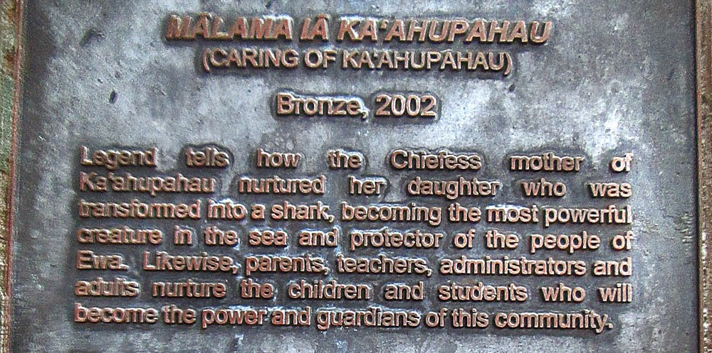
Ewa's cultural history has a long standing relationship with sharks- swimming with them,
riding them, feeding them and basically treating them like family pets. They are considered sacred guardians by some families who have a cultural history with sharks.

*******************************************************************************
So is Honouliuli a Traditional Cultural Property-Place (TCP) or not? The evidence says YES.


Much more archaeological work needs to be done before any further land development decision is made and before any further rail station and TOD construction begins on the HART Rail East Kapolei, West Oahu and Ho'opili stations. SHPD must ensure that Hawaii’s heritage is not destroyed, paved over or forgotten. During the past State administration the agenda was FULL ON BULLDOZING, NO QUESTIONS ASKED OR WANTED.
Like every other state agency, SHPD has to beg the governor and the Legislature for funding. The division receives $1 million from the state—less money than any other division in the Department of Land and Natural Resources—and nearly $500,000 from the federal government. Most of the total $1.5 million goes to SHPD’s 24 positions which remained largely UNFILLED during very critical stages of the HART Rail EIS and AIS.
FTA and HART IGNORED detailed public comments and testimony about
Honouliuli TCPS
When much of the HART rail AIS was done SHPD was at an extreme low point in staffing and with massive stacks of documents being thrown at an overworked skeleton staff under immense pressure from the City mayor, HART and FTA officials, and from high Washington DC political levels The orders were: Get AIS reviews done as fast as possible so that West Oahu rail segment could begin ASAP.
In Hawaii iwi kupuna burials are sacred. Yet HART is drilling in rail pylons and preparing rail stations and a huge urban sprawl around these same station locations for the benefit of land developers. Land developers will make a fortune from an FTA Federal tax payer funded project that was supposed to be about public transit, yet is actually all about creating an entirely new massive urban sprawl that will bring in tens of thousands of new cars, flooding already choked H-1 at service level F and creating major new water runoff and reef ecosystem pollution problems.
**********************************************************************
Bones of Contention
Ronna Bolante, Honolulu Magazine Nov 1, 2007
In 2002, state auditor Marion Higa slammed the division for a laundry list of offenses:
- Staff archaeologists often took months, sometimes years, to review reports.
- A burial program staff member accepted $1,000 from a developer whose project unearthed 200 burials.
- One-third of its employees took vacation or sick leave without recording it.
- Staff members worked for other employers during state hours for which the division compensated them.
Archaeologists and Hawaiians also question the qualifications of the staff left in the office. The only full-time person doing reviews on Oahu as of mid-September (2007), for instance, started at the Historic Preservation Division as an intern, Monahan says. She has no graduate degree in archaeology or anthropology.
SHPD’s geographic information system, which tracked historic sites, has also been out of commission for at least two years (add six more years until 2013), according to Monahan. During that time, staff members have had to record newly documented historic sites by handwriting them in a notebook on an office shelf. “If there’s a fire, it’s gone,” he says. “That’s the pathetic state of the division.” (Not much has changed except some new staff.)
But there was never enough time for archaeologists at the division. Each of the four major islands is supposed to have its own lead archaeologist. Three of them are also supposed to have assistant archaeologists. But as of mid-September (2007), there was only one lead archaeologist and two assistants—three staffers doing the work of seven.
“When I came in, there were literally stacks everywhere, so I just started shoveling, reviewing as fast as I possibly could,” Monahan says. “In the month of March, I did 112 reviews. A lot
of them meant digesting a 3-inch-thick report.” (Not much has changed except some new staff.)
After four months, Monahan realized that nothing would change. After eight, he quit. “I was working as hard as I possibly could and doing my best trying to help the whole system, everyone who depends on the process working, and I rarely had more than an hour to look at something,” he says. “I look back, and I think I would’ve made different or better decisions if I’d had more time.”
Maui’s lead archaeologist, Melissa Kirkendall, resigned from a post she’d held for seven years. She sent a letter to her colleagues, noting that there were more than 400 permits and archaeological reports pending review on Maui and the Big Island. “Given the present state of the Historic Preservation Division, we are no longer facilitating our ethical obligations,” she wrote.
(It was FAR WORSE when all the key FTA-HART Rail EIS-AIS approvals were reviewed.)
The survey told SHPD that there were at least 11 sets of human remains at the Ward Village Shops. With that information in hand, the SHPD should have foreseen that these burials were just the tip of the iceberg, says Thomas Dye, president of the Society of Hawaiian Archaeology, an association of 200 members.
He points out that the hired archaeologist surveyed just 3 percent of the property’s sandy area. “It stands to reason that there are many more in the other 97 percent—this is common sense,” he says. “I believe that there are about 330 sets of remains on the property. But SHPD’s review appears to have been very cursory. This issue isn’t brought up at all.” (Welcome to HART!)
Dye worked at the division for six years in the mid-1990s, so it’s incomprehensible to him that SHPD did not ask for more archaeological work at the site before construction began. It should have been a given, he says, since archaeological evidence shows that the property was once the back end of a beach—the kind of environment where early Hawaiians often settled—and, over the past 20 years, more than 300 unmarked graves have been discovered in Kakaako. (What about Honouliuli where at least a MILLION native Hawaiians are buried?)
He is especially concerned about the unique archaeological site on the Ewa end of the property, in the footprint of the planned condo—a rare find that could not only tell us how Hawaiians died, but lived. “In Kakaako, archaeologists have been looking for at least a quarter-century for an old Hawaiian living surface—the top of sand where people were making their houses, raising their families and digging holes to bury their dead,” Dye says. “We could find out when Hawaiians lived there, what kind of houses they built, what kind of wood they burned, whether they were fishing with nets or building canoes and going out in deeper water.” (But NOT in Honouliuli with ancient trails.)
As Hawaii moves forward, many people rely on SHPD to ensure that the state brings enough of the past with it.
That’s why the division needs to work, says Moses Haia, attorney for the Native Hawaiian Legal Corp.. “Hawaii had a history before there was Western contact, and that history is provided in the landscape for these Islands,” he says. “If most people truly believe that’s what makes Hawai‘i a great place to live and what brings people here, why isn’t the state protecting it?”
New Archaeology Technologies Can Locate West Oahu Ewa Plain Hawaiian Sites

HART Rail and Planned Transit Oriented Developments May Violate Numerous Federal Policy Acts
A Five-Minute Look at Section 4(f) Law That HART Rail Is In Violation Of In Honouliuli Ewa Traditional Cultural Properties


West Oahu Eco-Disaster: HART Rail Hitting Karst Water And Polluting Ewa-Honoululi-Waipahu Wetlands


Hawaiian royal cloak in Bishop Museum from 1825 HMS Blonde expedition to Oahu.